“I was sweating it a bit,” our captain confesses. “We only had 1.8 meters under the keel. On the way back, we need to steer a bit more to the west.” Sure, I say, but the GPS position from the pilot book was correct. “Well… ” he sputters.
You were too far to the east, I say. Didn’t I tell you that you needed to head more to port? “Oh yeah, that’s true. I’ll just listen to you from now on,” he smiles.
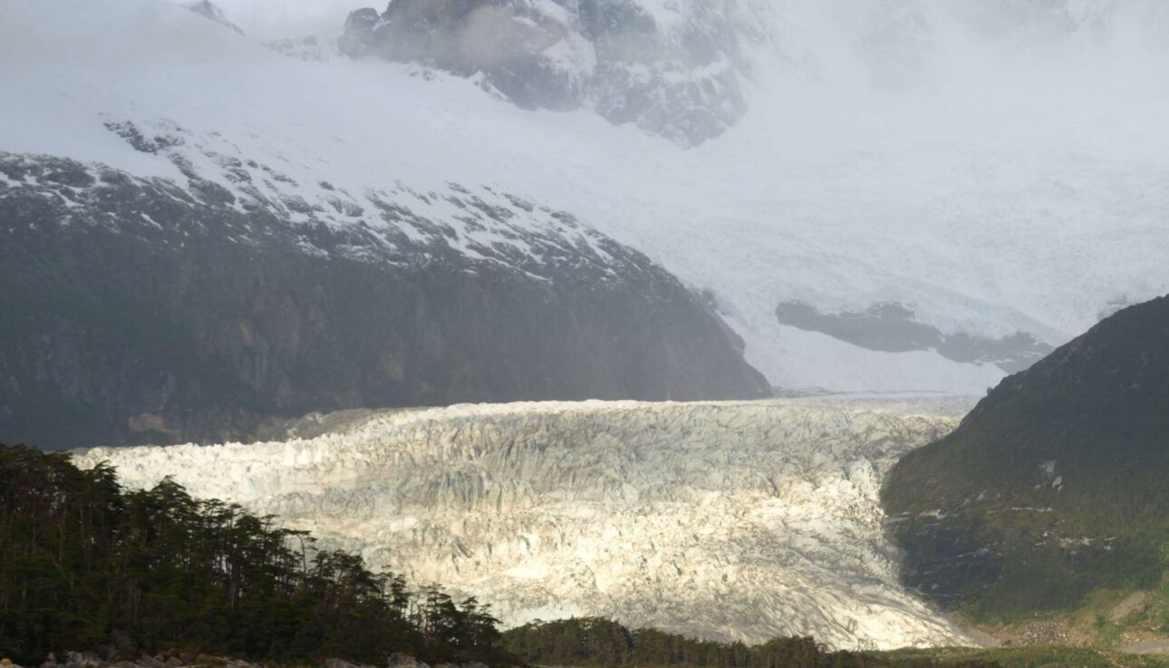
Last night we were anchored in a fjord, at the foot of a glacier, in a bay named Beaulieu. To get into the fjord, we had to cross a sill. The glacier pushes a lot of boulders and grit ahead of it as it grows. When it retreats, that stays behind at the end. And there, it forms a sill.
The problem with the sill is that you can’t see it. At the edge of the fjord, a few rocks stick out above the waterline, but at least 90% of the boulders lie treacherously underwater.
Only a very small part of the sill is deep enough to sail over, into the fjord. Fortunately, the pilot book states exactly which GPS position that low point is located at. But aiming for exactly that spot isn’t so easy in flowing water, without buoys or other markers.
Before that happens, we take the Zodiac to the glacier. For at least fifteen minutes, we find our way through the ice blocks, heading for a rocky point where we can go ashore. From there, we want to walk to the glacier.

It’s cold on the way in the Zodiac. The wind bites, and the snow makes it all a few degrees worse. But as soon as we’ve climbed out of the rubber boat, it stops snowing. And while walking, we’re warm in no time. Gloves can come off, jackets open.
The glacier growls. As if a thunderstorm is approaching. We stand still on a large rock opposite the glacier. Suddenly, a piece breaks off. The chunks of ice collapse and then find their way through the water, out of the fjord.
At the end of the afternoon, it’s also time for us to sail out of the fjord for the final leg of this journey: through the Beagle Channel to Ushuaia.
The captain and I take our positions again. Him at the helm with the depth sounder in front of him, me at the chart table with the GPS and the (huge) atlas of Chilean waters (very complete but only readable with a magnifying glass).
 After 20 minutes of sailing, we’ve reached the sill. Every 0.1 mile, I plot our position on the chart. Point by point. A bit to starboard, a bit to starboard. Exactly at the GPS position indicated in the pilot book, we pass the sill.
A sigh of relief goes through the wheelhouse. “When you’re a captain later,” says guest Dick, “I’ll sign on with you.” That’s fine, Dick, I’ll hold you to that, I say. “Navigating over that sill was the highlight of the trip,” guest Chris recalls during his speech at the farewell dinner in Ushuaia. And it certainly was.
The underwater sill is blue on the chart; the white part in between is our passage